- Overview
- Ensemble Met. Forcings
- Watershed Modeling
- Data Assimilation
- Met. Ensemble Forecasts
- Flow Forecast Post-processing
|
The forecasts produced in the OvertheLoop Prediction project leverage ensemble methods and a range of models that are integrated within an automated prediction system running at NCAR called the System for Hydromet Analysis, Research and Prediction (SHARP). SHARP is a modular system in which different components are executed via the python-based functionality of the ecFlow software. SHARP includes:
More detail describing these components can be found on the adjacent tabs. |
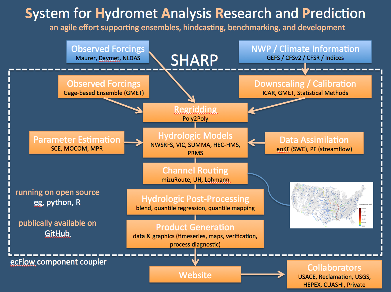 Schematic of the System of for Hydromet Analysis Research and Prediction |
|
Accurate real-time and retrospective meteorological inputs (forcings) are critical to running hydrology models for real-time to initialize model states for real-time forecasting. Most existing real-time gridded meteorological datasets are deterministic, giving little information about forcing uncertainties, which vary in time and space depending on each day's weather regime. Forcings errors lead to errors in model states, which propogate into model forecasts. To understand and use the uncertainty in model states to inform the forecasts, the current SHARP forecasts use a spatial regression approach to translate observed precipitation and temperature station measurements into a gridded ensemble of forcings for initializing the watershed model, and to support ensemble based data assimilation. This approach is applied via the GMET software, which was developed at NCAR. The ensemble forcings allow SHARP to simulate an ensemble of estimates of model initial conditions (currently 100), which represents the forcing-related uncertainties in model states. These are weighted by their agreement with observations such as streamflow, and the most likely state simulations are used to initialize the forecasts. Before the observed station data can be used in GMET, they are subjected to an automated QA/QC process, gap-filling and record extension based on CDF matching. Currently, SHARP draws stations from the GHCN-Daily and NRCS SNOTEL networks, with approximately 7000 stations downloaded and processed each morning. The 100-member ensemble forcings (Precipitation, Tmax, Tmin and PET) in use currently are at 1/16th degree resolution, from Jan-1-1970 to the day before present, finalized by 10 am MST, and covering the Pacific Northwest, California and the Upper Colorado, Front Range and Upper Rio Grande River basins. |
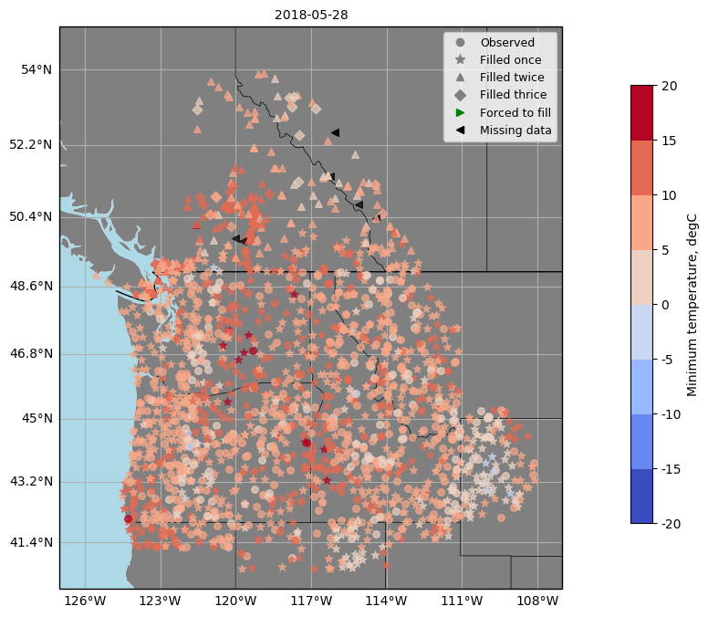 Minimum temperature observations for the PNW region 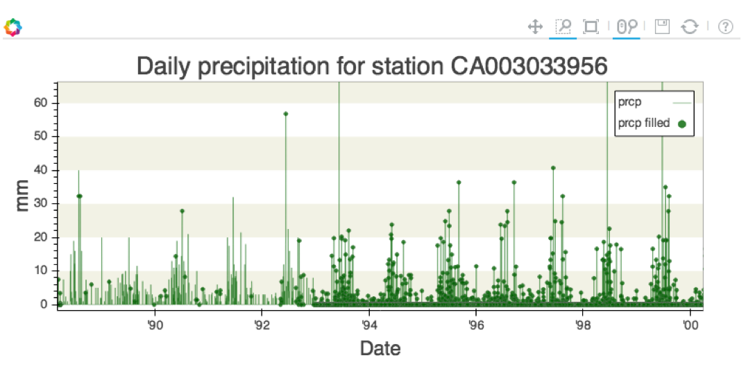 Example of a filled precipitation observation record 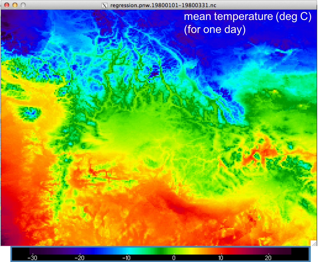 Gridded temperature fields at 1/16th degree over the PNW region 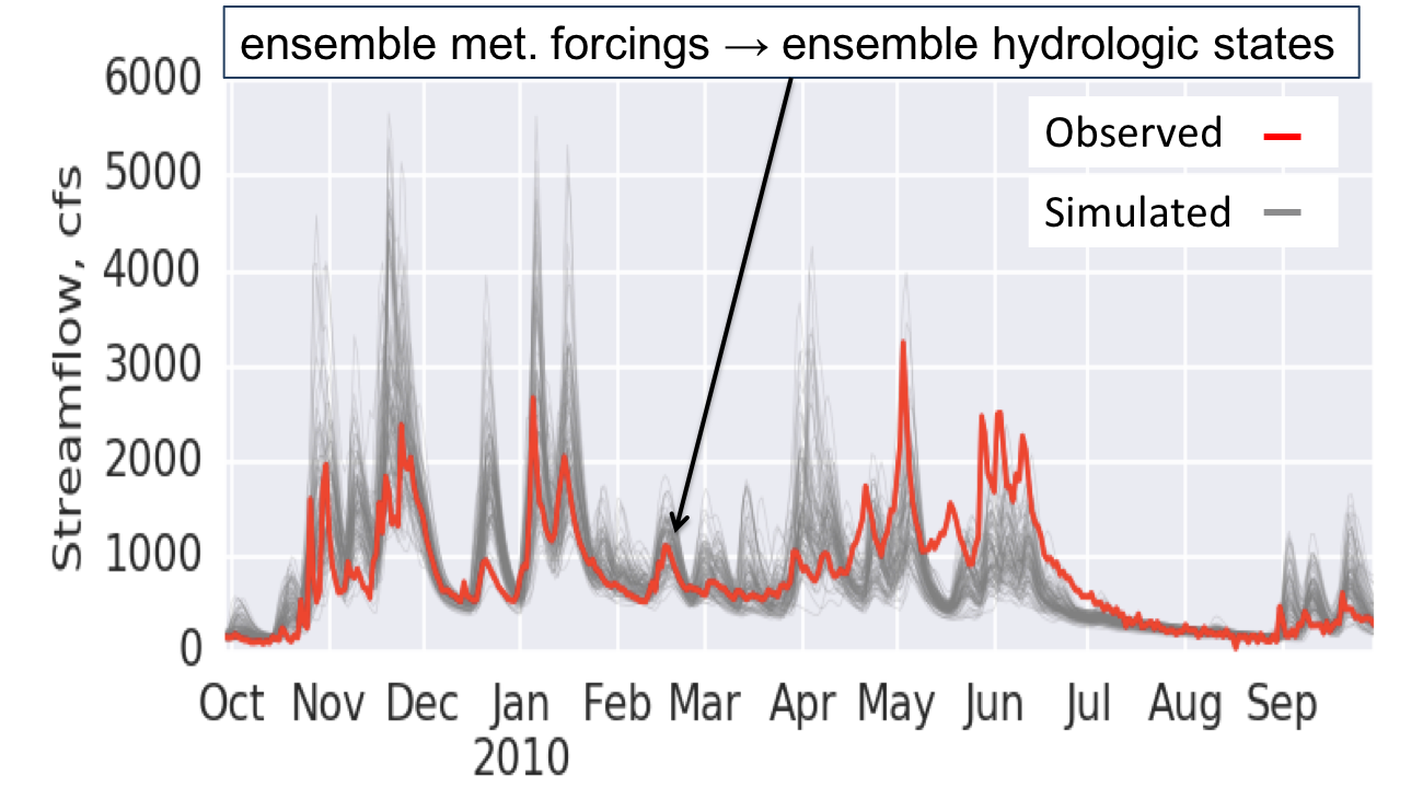 Ensemble streamflow simulations resulting from ensemble forcings |
|
The Over-the-Loop forecast project centered on technique development and demonstration, and used traditional conceptual forecasting models (Sacramento and Snow17, with unit hydrograph routing) while investigating meteorological forcing, data assimilation, parameter estimation, meteorological forecast downscaling, and post-processing approaches. Currently, the project has turned to applying these techniques for a more complex, fully process-oriented modeling strategy involving the SUMMA hydrologic model and mizuRoute routing model. This transition is in progress. The configuration of SUMMA designed for forecasting applications is at an intermediate spatial scale (HUC-12), and a 3-hourly timestep, with a 5-layer snow model and a 3-layer soil structure, below which is an aquifer with VIC-like baseflow drainage algorith. The channel routing is on the NHDPlusV2 network. The figures at right illustrate the model implementation and model components. |
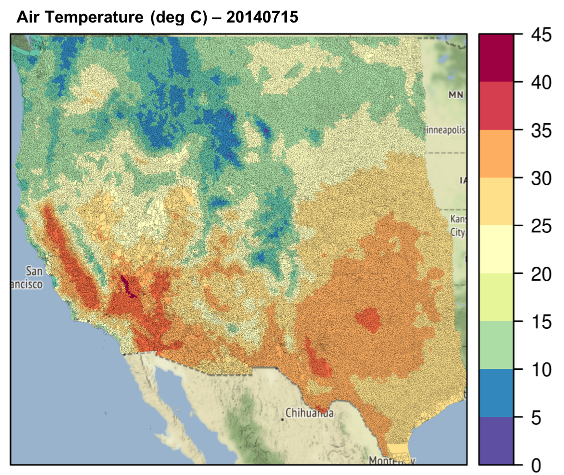 Western US intermediate-scale HUC12-based modeling domain (showing temperature) 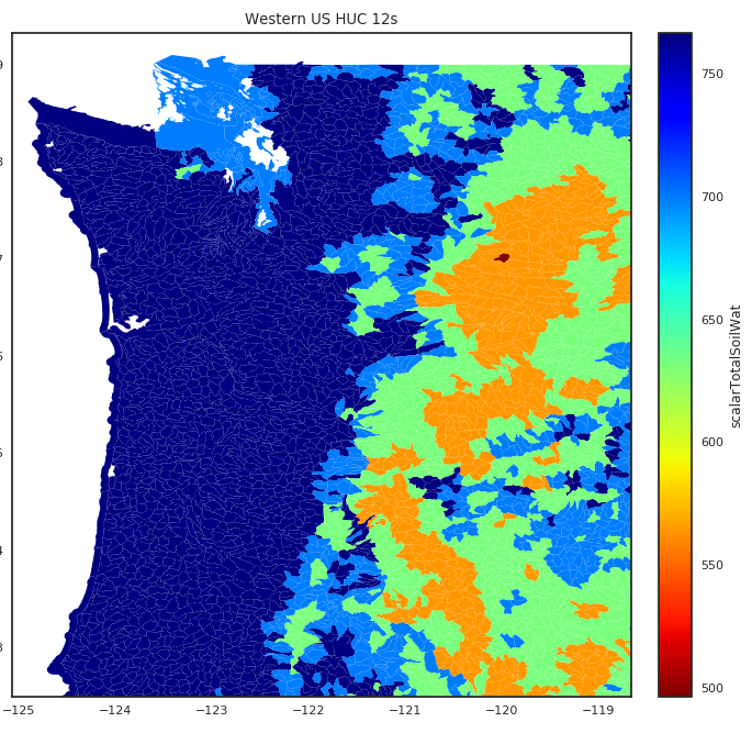 Close-up on model HUC12 resolution for Puget Sound region, WA (showing model SWE) 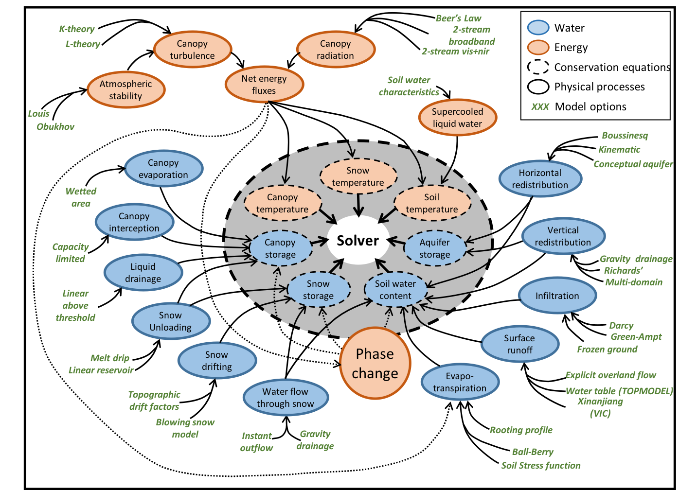 SUMMA hydrologic model framework schematic 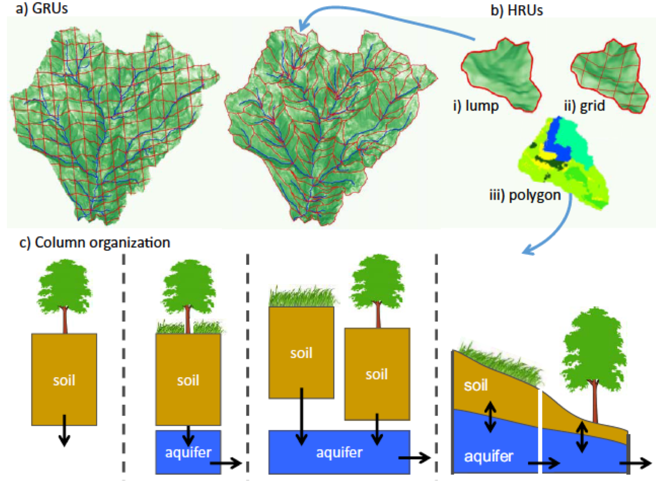 SUMMA hydrologic model configuration alternatives 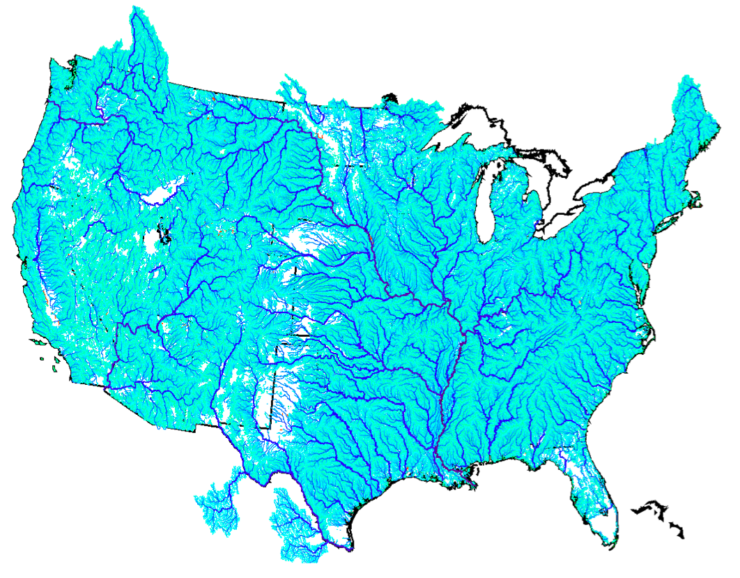 mizuRoute channel routing model applied on the NHDPlusV2 network for CONUS |
|
Hydrologic model initialization for forecasting is one of the most difficult challenges in streamflow prediction. Errors in the modeled watershed states at the time of the forecast are ever-present, as a result of approximations in model specification (physics, parameters) and in model meteorological inputs (forcings) leading up to the forecast date (the 'spin-up'). In the current 'forecaster-in-the-loop' practice, expert forecasters adjust model states, forcings and parameters to achieve a good fit between the model simulation during the spinup period, before starting a forecast. In an 'over-the-loop' system, this goal is, in theory, achievable through a statistical technique called 'data assimilation'. Automated hydrologic model data assimilation is complex, and difficult to apply reliably in operational settings, hence is not yet widely used in most forecasting centers. |

|